Sunday, 28 August 2022

WEGA Excursion to the Lake District

 WEGA Excursion to the Lake District


WEGA needs a few more participants to make this excursion viable. It will run from Friday 21st to Tuesday 25th October. 

At Blencathra FSC


Course Outline - by own transport but car sharing can be arranged.


Friday 21st - travel to Blencathra Field Studies Centre. (Field Studies Council - Blencathra FSC Blencathra, Keswick CA12 4SG, UK) Introduction, meal, overnight accomodation.

The following suggestions for the trip are from the person who will be leading from the FSC James Margeson <j.margeson@field-studies- council.org>


Sat
Morning: School House Quarry (Skiddaw Slate), Mungrisdale. Access is a 100m walk from roadside parking around 20 minutes drive from the centre.

Afternoon: Glenderterra metamorphic aureole. 4km round walk on a bridleway track from the centre. ~50m ascent and descent.

Sun
A day dedicated to the Borrowdale Volcanic Group. This rock group is probably the trickiest to access in terms of walking and parking.

I’m thinking perhaps a walk from the Honister slate mine car park to the quarries on Fleetwith Pike, about 3km and 100m ascent on a vehicle access track. This is one we can discuss though as there are a few different options we could look at.

Mon
I would suggest a visit to Shap Pink Quarry and the Shap Well unconformity. Both involve very short accessible walks. This would suit participants travelling south at the end of the course.

The field locations will be a mix, reflecting the varied and distinctive geology of the Lake District.

Cost £404.60 per person for residential field course.

In order to confirm your participation in the event, we do need a deposit please of £100 per person, which will be collected by our treasurer Judy Hible (email : judyhible@talktalk.net)

Please advise me, as (temporary, acting) Field Secretary that you are coming on the trip.  Or please email me with any questions: Janet Hellen <jdhellen@btinternet.com

Saturday, 20 August 2022

Sizing a Shark - The Cosmopolitan Predator

Sizing a Shark - The Cosmopolitan Predator 

I came across THIS ARTICLE in The Guardian, it is based on this ACADEMIC PAPER, and concerns a study of the extinct shark Otodus megalodon. 

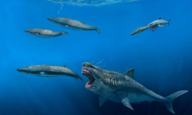
Sharks do not have bones, so fossils are rare. Most shark remains are teeth So to get a picture of megalodon the researchers had to create a 3D model. And the results were that megalodon was 16 metres long and weighed 70 tons. We can be pleased that it went extinct 2.6 million years ago.

The beasts teeth are found all over the (marine) world, hence its description as a cosmopolitan predator.

The authors go into speculation about the affect such creatures would have on their surrounding ecology and come to the conclusion that it would have been the apex predator, able to eat anything in the ocean, including the largest whales.

Megalodon seems to compete with Tyrannosaurus rex for the title of scariest dead beast. I do not think I would like to meet either of them.


At around 50 feet (16 metres) from nose to tail, the megalodon was longer than a bus. Photograph: JJ Giraldo/AP

Thursday, 18 August 2022

1 Day Field Course with Nick Chidlaw

1 Day Field Course with Nick Chidlaw

Nick Chidlaw has asked me to publicise this field course which he wants to run in October. All the details are below. 

--------------------------------------------
A CIRCULAR WALK IN SOUTH GLOUCESTERSHIRE: shallow tropical seas and rivers, ice age valley incision 

Sunday 2nd October 10.00 am - 5.00 pm

The generally low-lying landform of much of the county of South Gloucestershire is interrupted near the village of Cromhall by a steep sided, narrow meandering valley lined by rocky crags. The base of the valley was dammed in the 19th century to form a 700m+ long lake, part of the grounds of Tortworth Court (now a hotel). Some 40m deep, the valley is short: indistinguishable from the surrounding countryside only 2 miles to the south of the lake, and likewise so in the open ground on the lake’s north-west side. The stream that feeds and exits the lake is small, and is a ‘misfit’, occupying a valley cut by much more powerful waters during the ice age. Rock exposures, including the natural crags, track cuttings and old quarry workings provide an opportunity to examine the local character of successive stratigraphic units of the Carboniferous Limestone Supergroup. The strata dip 20 – 30 degrees to the south and south east, demonstrating the structural contrast between that found north and south of the ‘Variscan Front’ in the Bristol area, established by the end of the Carboniferous period some 300 Ma. No previous knowledge of geology or the area will be assumed.   


A handout outlining the day’s programme, including location sketch map, geological map and cross section, illustrated geological history and written log of the succession of strata, will be forwarded in advance of the course to those enrolled.


Note that enrollees will need to:


*     Arrange their own transport

*     Bring a packed lunch and any refreshments (e.g. flask of coffee, fruit juice, mineral water etc.)

*     Wear strong footwear with good tread and ankle support, and have waterproof clothing if weather is poor.

*     There will be no requirement to wear hard hats on this course. 


Attendees will be insured against accident for the duration of the course. 


Tuition fee: £30.00 


Contact tutor Dr Nick Chidlaw nickchidlaw@gmail.com to enrol and for any queries. 

Deadline for course viability: Saturday 10th September. If the course has become viable (minimum of 10 enrolments) by this date, enrolments will be able to continue until 1 week before the course runs (Sunday 25th September).   


Google Earth oblique image of the study area, looking south showing the abruptly-incised meandering valley and lake near the village of Cromhall. 


Track cutting in the Cromhall Sandstone Formation (Middle part). The character of the Carboniferous Limestone Supergroup changes notably between South Gloucestershire and the Mendips; in this area in the north, reddish quartz sandstones and mudrocks, deposited in rivers, occupy much of its upper part and are virtually absent in the south. 

------------------------------------

This looks an intriguing excursion. I would sign up for this one but will be in the USA with Dave Green on the 2nd October. 

Have we Got to the Bottom of this Mystery?

Have we Got to the Bottom of this Mystery?

A correspondent sent me the link to THIS ARTICLE on the BBC website. It is based on THIS ACADEMIC PAPER, two of whose authors are at Bristol University.

Saccorhytus coronarius has been known for some time but has proved difficult to place in a family. It is early Cambrian in age and microscopic in size. The fossils studied come from China. It was thought to be a deuterostome but is now classified as a ecdysozoan. To quote "Saccorhytus testifies to the remarkable morphological disparity and ecological diversity of early Cambrian ecdysozoans and presents another case of secondary absence of the anus in ecdysozoans."

I do not pretend to understand the arguments for the creatures classification. But I am amazed at the quality of the illustrations which use both scanning electron microscopy (SEM) and synchrotron radiation X-ray tomographic microscopy (SRXTM).


Anatomy of S. coronarius. a,b, He22-45, with a single large protuberance. a, Lateral view. b, Close-up view of sixth lateral body cone. c–e, He22-94, SRXTM images. c, Surface model, lateral view. d,e, Virtual sections through body cones as denoted in c. f–h, He22-57, with two large protuberances. f, Apertural view. g, Virtual section through radial folds as denoted in f, bisecting a circumapertural protuberance. h, Virtual section through radial folds as denoted in f. Scale bars: 200 μm (a,c,f), 110 μm (b), 55 μm (d), 80 μm (e), 50 μm (g,h)


Anatomy of S. coronarius. a–e, UMCU2020021. a, Lateral view. b, Right view. c–e, Detail of body cones tilted approximately 40° from a,b, showing remnant of apical spine. f,h, UMCU2016008. f, Lateral view. h, Detail of fourth lateral body cone adpressed against body wall. g,i, UMCU2016010. g, Abapertural view. i, Detail of small abapertural spines adpressed against body wall. j,k, UMCU2018012. j, Right view. k, Detail of fifth right body cone adpressed against body wall. l, UMCU2019018, abapertural lateral view. Scale bars: 200 μm (a,b,f,g,j,l), 60 μm (c–e,h,i,k).

Did the Chicxulub Asteroid have a Companion?

Did the Chicxulub  Asteroid have a Companion? 

Soon after I noticed THIS ARTICLE on the BBC website, several people also mentioned it. It tells us about the discovery, off the west coast of North Africa, of a meteor crater which has an age similar to that at Chicxulub - the one that killed off the dinosaurs! (allegedly). You can read more about the discovery HERE. Both stories are based on THIS ACADEMIC PAPER.

The techniques used to find the crater are far from simple but we end up with a simple story. A smaller asteroid hit the Earth about the same time (geologically speaking) as the asteroid which marked the demise of the dinosaurs and other creatures. Was there a connection? - We do not know. 

The three papers discuss the possibilities in ever increasing detail but we may never have a definitive answer. But we do have a nice story.


Seismic characteristics of the Nadir Crater.
(A) Seabed depth map of crater showing seismic line locations and the mapped extent of the crater rim and damage zone. (B) W-E seismic section (pre-stack depth migration – depth domain) across the crater, highlighting the crater morphology and damage zone, and the extent of subsurface deformation. Data courtesy of the Republic of Guinea, TGS and WesternGeco. Stratigraphic key is on Fig. 1. (C) Detailed seismic stratigraphic and structural elements of the crater. KP, Cretaceous-Paleogene sequence (KP1 equivalent to Top Maastrichtian); KU, Upper Cretaceous seismic horizons. KU1 and KP1 “regionals” are schematic reconstructions of these seismic horizons before formation of the crater at the end of the Cretaceous and are used to reconstruct a conceptual model of crater formation (Fig. 5). (D) SW-NE seismic section (pre-stack time migration – time domain) across the crater, showing crater morphology and seismic facies outside the crater, including high-amplitude seismic facies sitting above a ~100-ms-thick unit of chaotic reflections, interpreted to have formed as a result of seismic shaking following the impact event. Data courtesy of the Republic of Guinea and WesternGeco Multiclient.

Saturday, 13 August 2022

Icelandic Volcano Becomes Newsworthy - Again!

Icelandic Volcano Becomes Newsworthy - Again! 

That Icelandic volcano has started becoming spectacular again. This time it started off as a fissure eruption but seems to have centred on a single place of eruption. YouTube is full of videos not all of which are worth watching. My favourite is The Reykjavik Grapevine which is a local reporter (with a rather good video guy) who have found world-wide interest with the eruption. Their latest is HERE. You can see it below.


Wednesday, 10 August 2022

Eocene Birds Go to Edinburgh

Eocene Birds Go to Edinburgh 

A correspondent sent me THIS LINK, which demonstrates the value the.. amateur palaeontologist still has for the science.

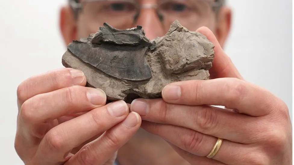
Michael Daniels spent a lifetime collecting fossilised birds from London Clay nodules, eroded out of the cliffs at Walton-on-the-Naze. He must have spent an age extracting the delicate bird bones from the clay.

On a visit to Edinburgh he discussed his collection with a curator at the National Museum of Scotland and promised him his collection when he died.

This came to pass last year and now Michael's fossils are in Edinburgh, available for study.


GeoNews Summer 2022 Edition

GeoNews Summer 2022 Edition 

The latest edition of GeoNews is available HERE. Or you can read it below.