Monday, 30 December 2024

Fossil Tree Found at Saltern Cove, near Paignton

 Fossil Tree Found at Saltern Cove, near Paignton

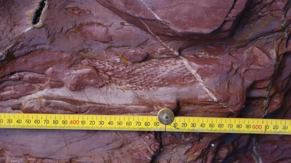
A correspondent alerted me to THIS WEB PAGE on the BBC website. It concerns the finding of a lycopsid (tree) fossil at Saltern Cove. It is important because the area was thought to be marine in the Devonian and the tree indicates that there was a desert island. I wonder if the tree grew here or whether it floated in.


You can find out a great deal more about the find at THIS ARTICLE published by the English Riviera Global Geopark.

Monday, 23 December 2024

Making "White" Hydrogen - Pity About the Ophiolite

 Making "White" Hydrogen - Pity About the Ophiolite

I came across THIS ARTICLE which discusses the various means of making Hydrogen, most of which are very environmentally unfriendly. There is a colour coding of Hydrogen which describes how it is made.

And the "greenest" hydrogen is White Hydrogen! This is already being produced by natural geochemical processes. This involves the weathering of basic igneous rocks.

This could be industrialized by pumping water and carbon dioxide into ophiolites. This produces serpentine, magnesium carbonate and hydrogen. So get rid of carbon dioxide and produce hydrogen! 

This sounds very good. Presumably there would be difficulties, but the techniques used are those of the oil industry which might encourage their use.

As far as I am concerned the downside is the change of lovely ophiolites into less lovely serpentinites.


Saturday, 14 December 2024

Nautilus Video

 Nautilus Video

A correspondent alerted me to this video and it makes nice pleasant viewing. It is even more pleasant if you mute the sound.


All you need to know about Nautilus can be found HERE.

Saturday, 30 November 2024

Down to Earth Extra December 2024

 Down to Earth Extra December 2024

The December 2024 edition of Down to Earth Extra has been published. You can download it HERE or you can read it below.


Saturday, 16 November 2024

Crystals Hold Secret of When Volcanoes Erupt

Crystals Hold Secret of When Volcanoes Erupt

I came across THIS ARTICLE in the New Scientist and found it very interesting for several reasons. Its about igneous petrology, Hawaii and volcanoes - what more do you need! It is based on THIS PAPER in Nature.

The researchers used several techniques of studying crystals - mainly olivine - from the 2022 eruption of Maunu Loa to determine the history of the crystals before the eruption. And they found that they had started moving into a higher magma chamber 70 days prior to the eruption. The eruption occurred when this chamber was full.

And seventy days prior to eruption a change in earthquake frequency and ground bulging (inflation) was noticed.

So if a similar change in inflation and earthquake frequency was noticed a warning of imminent eruption could be given.

Studies to see if similar things happened to Mauna Loa and other volcanoes prior to other eruptions are being carried out.

But the Hawaii volcanoes are among the most studied anywhere. Is there sufficient knowledge of other volcanoes to make predictions?

Looking at the Nature paper reminds me that igneous petrology has moved on considerably since I was a student!


A Map of Mauna Loa summit and upper Northeast Rift Zone (Island of Hawai‘i on inset map) with 2022 lava flow field78 (pink), lava flows since CE 184379,80 (dark gray), 1000 ft (~305 m) contours (brown lines), samples (black dots; green for large-volume tephra samples used for mineral chemistry), and monitoring network stations (various symbols; see Fig. S1 for wider view that includes all GPS stations in this study). Basemap generated from a 2005 NOAA digital terrain model81 and a 1983 USGS digital elevation model82. Caldera bounding faults are denoted as black lines with teeth pointing to the downthrown side and 2022 eruptive fissures are denoted with red lines. The 2022 flows crossed the NOAA Observatory access road (dashed black line) and came within ~3 km of Highway 200 (Daniel K. Inouye Highway, “Saddle Road”). B 3-D X-ray computed tomography scan (μCT scan) of an olivine from sample ML22-88 shows the rounded morphology typical of phenocrysts from this eruption and inclusions of melt (yellow), Cr-spinels (red), and fluids (blue). C Phosphorus and D magnesium X-ray element maps of an olivine crystal. Sharp truncations in phosphorus zoning record at least two dissolution events. Patchy zones of truncated high-phosphorus in the phenocryst interior represent older resorption histories, whereas truncation of secondary phosphorus branches by the crystal-melt boundary record the youngest resorption event that is also evident in the rounded morphology of the phenocryst. Diffusion gradients in magnesium show obvious differences along the a- vs. c-axes (shown in lower-hemisphere stereonet inset in C), a result of diffusion anisotropy. Part of the crystal rim in the a-axis direction also shows subtle skeletal rim texture, evidence of late-stage crystal growth.
Saturday, 2 November 2024

Down to Earth Extra November 2024

 Down to Earth Extra November 2024

The November 2024 edition of Down to Earth Extra has been published. You can download it HERE or you can read it below.


Wednesday, 23 October 2024

Giant Meteorite Strike - the Pluses and Minuses

 Giant Meteorite Strike - the Pluses and Minuses

A correspondent sent me THIS LINK, concerning a giant meteor strike which happened ~3.26 Ga in what is now the Barberton Greenstone Belt of South Africa. I now know that 8 meteorite impacts (identified by small spherules and iridium anomalies) occurred in the greenstone belt. They have been given S numbers and here we are dealing with S2.

The size of the meteor was huge - 40 to 60km across. The Earth it struck was very different from that of today - mostly sea with a few continents. Life was single celled organisms. The meteorite created a 500km crater, a cloud of hot rock dust that circled the globe, ripped up the sea bed and created a huge tsunami. 

But it is not all bad news. Phosphorus and iron were churned up and dispersed. This could be considered as the spreading of fertiliser! It is always good to look on the bright side of life!

The basis of the BBC article is THIS ACADEMIC PAPER. This goes into the minutiae of the investigation and gives much greater detail. 


Rock and thin section images of the Bruce’s Hill and Umbaumba sections. (A–C) Outcrop photos of the Umbaumba section. (A) Overview of the Umbaumba section showing, from base to top, BWBC, S2, fallback layer, and BWBC. (B) S2 spherule bed. (C) Lower part of the fallback layer showing fine laminations. This black chert is composed of silicified carbonaceous matter, siliciclastic debris, and impact-generated dust settling out of the atmosphere. (D and E) Outcrop photos of the Bruce’s Hill section. (D) BWBC below S2. (E) Alternating siliciclastic and siderite-rich chert beds. (F–G) Representative thin section images of carbonaceous matter. (F) Laminated carbonaceous chert below S2 in the Umbaumba section (SI Appendix, Fig. S4). Red arrows indicate fractures filled by chert. (G) Clots of carbonaceous matter and other siliciclastic debris from the fallback later in the Umbaumba section.